
• Link to X
  • Link to Facebook
  • Link to Instagram
  • Link to Youtube
  • Link to Pinterest
  • Link to LinkedIn
  • Link to TikTok
  • Link to Vimeo
  • Belvedere
  • Corte Madera
  • Fairfax
  • Greenbrae
  • Kentfield
  • Larkspur
  • Mill Valley
  • Novato
  • Ross
  • San Anselmo
  • San Rafael
  • Sausalito
  • Stinson Beach
  • Tiburon
415-847-5584
Thomas HenthorneGolden Gate Sothebys International Realty logo
  • About Thomas
    • About Me
    • Testimonials
    • Homes Sold
    • My Sizzle Reel
    • Social Media
    • The Sotheby’s Advantage
    • FAQ | Frequently Asked Questions
  • My Listings
    • 107 Diablo Drive | Kentfield

      Front approach of 107 Diablo Drive in Kentfield, California with Mount Tam in the distance
    • 128 Tamalpais Avenue | Mill Valley

      Living room at 128 Tamalpais Avenue in Mill Valley, California
    • 95 Irving Drive | San Anselmo

      95 Irving Dr San Anselmo home for sale with pool, gardens, and surrounding hills at sunset
    • 2395 Sobre Vista Road | Sonoma

      2395 Sobre Vista Road in Sonoma California living room with sunset
    • 1642 W. Kuiaha Road | Maui, Hawaii

      Modern Maui estate with large glass windows surrounded by lush greenery, landscaped garden, and a swimming pool, set against a backdrop of tall trees under a clear evening sky.
    • See All My Listings HereThomas Henthorne
  • Homes Sold
  • About Marin
      • About Marin County
      • Top 12 Reasons To Move To Marin
      • Best Marin Hikes
      • Marin Schools Guide
      • Waterfront Homes in Marin County
      • Marin Towns Overview
        • Marin Towns and Neighborhoods
        • Belvedere
        • Corte Madera
        • Fairfax
        • Greenbrae
        • Kentfield
        • Larkspur
        • Mill Valley
        • Novato
        • Ross
        • San Anselmo
        • San Rafael
        • Sausalito
        • Stinson Beach
        • Tiburon
  • Open Houses
    • All Marin Open Houses
    • Corte Madera Open Houses
    • Fairfax Open Houses
    • Greenbrae Open Houses
    • Kentfield Open Houses
    • Larkspur Open Houses
    • Mill Valley Open Houses
    • Novato Open Houses
    • Ross Open Houses
    • San Anselmo Open Houses
    • San Rafael Open Houses
    • Sausalito Open Houses
    • Tiburon Open Houses
  • Search Homes
      • Quick Search Marin Homes
      • Belvedere Homes for Sale
      • Corte Madera Homes For Sale
      • Fairfax Homes For Sale
      • Greenbrae Homes For Sale
      • Kentfield Homes For Sale
      • Larkspur Homes For Sale
      • Mill Valley Homes For Sale
      • Novato Homes For Sale
      • Ross Homes For Sale
      • San Anselmo Homes For Sale
      • San Rafael Homes for Sale
      • San Geronimo Homes for Sale
      • Sausalito Homes For Sale
      • Stinson Beach Homes For Sale
      • Tiburon Homes For Sale
      • Single Story Homes for Sale in Marin County
  • Market Reports
    • Marin Real Estate Market Reports
      • Monthly Marin Real Estate Market Reports
    • Marin County Market Stats
      • Marin County Overall
      • Belvedere
      • Corte Madera
      • Fairfax
      • Kentfield
      • Larkspur
      • Mill Valley
      • Novato
      • San Anselmo
      • San Rafael
      • Tiburon
  • Guides
    • Buying A Home In Marin
      • Learn About Buying a Home in Marin
      • First Time Homebuyer Guide
      • Most Affordable Towns & Areas
    • Selling A Home in Marin
      • Learn About Selling a Home in Marin
    • Marin Schools
      • Marin Schools Guide
    • How Much Is My Home Worth?
      • Find Out Your Home’s Value
    • Frequently Asked Questions (FAQ)
      • FAQ | Frequently Asked Questions
  • Blog
  • Your Saved Homes
  • Contact
  • Click to open the search input field Click to open the search input field Search
  • Menu Menu
You are here: Home1 / Marin Real Estate Blog | Marin County Real Estate News | Marin County Lifestyle2 / Marin County Hikes3 / Horse Hill – Alto Bowl Preserve Hike | Marin County Hikes

The Horse Hill-Alto Bowl Preserve Hike: Incredible Views & “Working” Horses

Marin County Loop Hikes
byThomas Henthorne|February 13, 2026|inMarin County Hikes, Marin Lifestyle
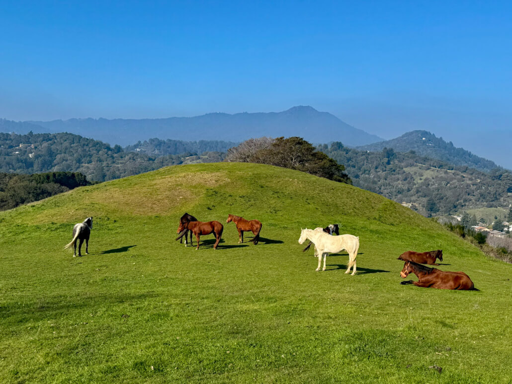
Horse Hill featuring group of horses, including brown and white ones, graze and rest on a green grassy hill under a clear blue sky with Mt. Tamalpais and trees adding to the scenic backdrop.

The Horse Hill Hike Between Mill Valley and Corte Madera is Truly Spectacular

Looking for a 45-minute hike that combines Marin history, incredible views, and a classic “Old California” ranch vibe right off the highway? Like many who drive Highway 101 through Mill Valley, I had driven past the iconic grassy knoll known as “Horse Hill” thousands of times. I always assumed the herd I saw grazing there was just part of a private ranch I couldn’t access. Little did I know, this is actually the Alto Bowl Open Space Preserve, and it offers one of the most beautiful “top of the world” loop hikes in Marin County!

As you will read in the Horse Hill history below, these fourteen horses may look like they are relaxing, but they are working, keeping the grass trimmed and helping reduce wildfire risk.

Horse Hill Hike Quick Facts

  • Time: About 45 mins -1 hour depending on route and how much time you spend talking to the horses (from a distance)
  • Gorgeous views: San Francisco Skyline, Richardson Bay, Mt. Tamalpais.
  • The Horses: Usually up to 14 horses graze here; do not feed or pet them. Typically they go up the hill in the morning and come back down in the mid-afternoon.
  • Trail Directions: Well-signed and easy to follow
  • Difficulty: Moderate grade suitable for beginner to intermediate hikers
  • Terrain: Single-track trails (can be muddy in winter) and fire roads.
  • Amenities: No drinking fountains or restrooms. Garbage cans and dog waste bags near parking.
  • Poison oak just off the trail farther north in the Alto Bowl preserve
  • Cell Service: AT&T excellent, Verizon excellent except near Scott Valley Swim & Tennis Club
  • Quiet: Be respectful of neighbors and always yield to horses, keeping dogs away from them (see trail rules below)
  • Safety: Do not leave valuables in car
View the Top 10 Best Hikes in Marin Here

Horse Hill Hike – Getting There

This hike is easily accessible from Mill Valley and is just 5 minutes from the freeway. From Hwy 101, take the Tiburon Blvd / E Blithedale Ave exit and head west on E Blithedale towards Mill Valley. Turn right on Tower Drive (near the Redwoods), right on Plaza Drive, and follow Plaza up to Lomita Drive. To get to the barn and parking lot, turn right on Lomita and follow it to where it ends at the parking lot and stable (right next to 101).

If the parking lot is full, turn around, and drive west on Lomita about 3 minutes until you see the Dollar Fire Road trailhead on the right. There is street parking all along Lomita. Take the fire road up to the top and rejoin the walkthrough at step #4.

Maps were disabled by the visitor on this site. Click to open the map in a new window.

Horse Hill Hike Map

Park in the parking lot (red circle) and follow the trail up and counterclockwise in a loop back to the parking lot. You will be on single track trails, fire roads, and even public streets for a short period of time. (See walkthrough below.)
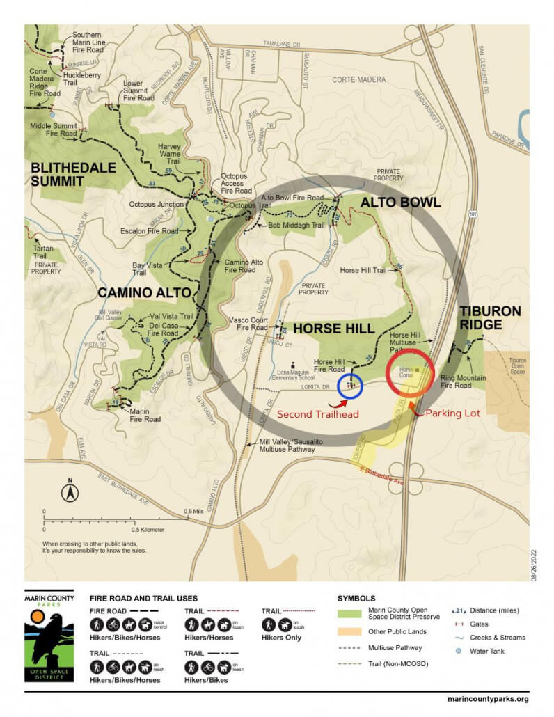
Horse Hill Hike Map with hiking area circled in grey, and parking areas marked with red and blue circles.

Read About the History of Horse Hill Here

A History of Preservation: From Dairy Farm to Open Space

Before it was a hiking destination, this land was a working landscape deeply rooted in Marin’s agricultural past. Originally part of the Rancho Corte Madera del Presidio land grant, the area became the Alto Dairy in the early 1900s, where cattle grazed these exact slopes.

However, the open space we enjoy today was nearly lost; throughout the 1960s and 80s, developers proposed massive projects for the site, including one plan for 1,200 apartments that would have covered the hillside. Local residents, led by preservationists like Aline McClain, fought for decades to stop the bulldozers. In a true community victory, the “Save the Horse Hill Committee” raised the necessary funds in the late 1980s to purchase the land for the public.

Today, the Alto Bowl Horse Owners Association keeps that ranching spirit alive, managing the herd you see from the highway—a living tribute to the land’s history and a functional team working to reduce fire risk.

Take a moment on your hike to think of all those who worked to preserve this beautiful area for future generations.
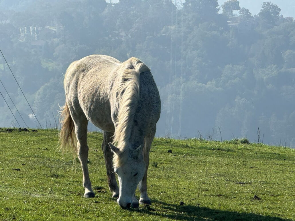
A light-colored horse grazes on a grassy hillside with trees and a hazy, forested landscape in the background on a sunny day.

Horse Hill Hike Rules

This beautiful hike is a gift to us from Marin citizens who worked years ago to preserve this land so we could enjoy it. Please respect the posted rules.

Horse Rules:

  • Do not feed the horses! You might think you’re being nice to the horses, but you may actually be causing harm or even death.
  • Stay at least 20 feet away from the horses, unless invited to approach by a horse handler.
  • Do not touch the horses.
  • Watch your children at all times and keep dogs on leash around horses.

Trail Rules – Horses Always Have the Right of Way

Dogs:

  • Leash Policy: Dogs must be leashed on signed trails (leash max 6 feet). They may be off-leash on fire roads only if under voice control, but you must still carry a leash.
  • Restrictions: Maximum of 3 dogs per person. No commercial dog walking.
  • Waste: Owners must clean up and remove pet waste.

Bikes:

  • Permitted only on signed fire roads and trails designated for multi-use.
  • Speed Limit: 15 mph max. Must slow to 5 mph when passing others or around blind turns.

Horses:

  • Permitted on signed fire roads and designated trails. Off-trail use is prohibited (except when watering or resting the horse).

General:

  • Stay on trails/roads; off-trail use is prohibited to protect the habitat.

Emergency Contacts:

In an Emergency: Call 911

Open Space Rangers: (415) 473-2816

Horse Hill Hike Overview

Step-by-Step Guide. Scroll down for the visual walkthrough or click bolded titles to jump directly to photo for that step.

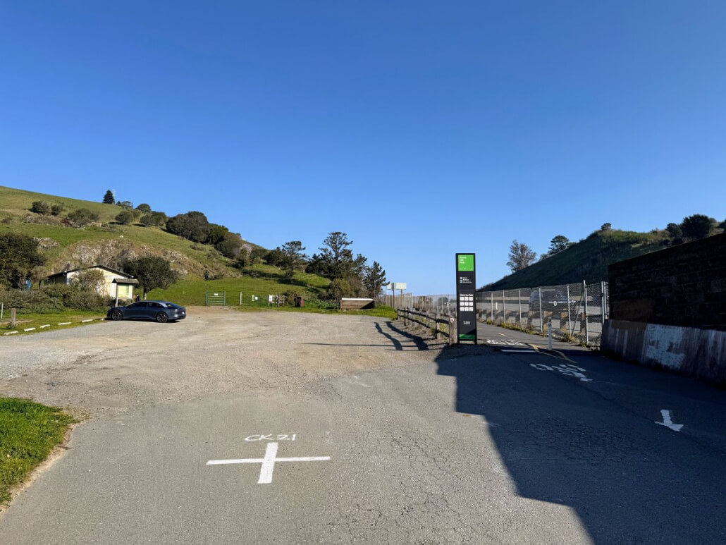
  1. Start at the Lot: Park in the designated parking lot and enter through the trailhead gate to the north (the freeway will be on your right). Please be sure to close the gate behind you to keep the horses safe.
  2. The Feed Area: You will enter a dirt area with large tires on the ground used to hold feed for the horses. If you’ve timed your visit right, you won’t see any horses here because they are already grazing up on the hill!
  3. Begin the Ascent: Go off to the left (your back towards 101) and start hiking up the dirt trail. You will be doing a counter-clockwise loop starting with the peak, winding your way around through Alto Canyon and Scott Valley Swim and Tennis Club, then back to the junction in step four. Watch where you step – the horses also use this trail!
  4. The Main Junction: Hike up to the top and turn right on the fire road. This is the “Main Junction” you will circle back to in Step 16. You may start seeing horses at this point—remember to stay at least 20 feet away from them. You’ll see electric lines and towers on your right as you ascend. You are here now.
  5. Climbing Up: Climb up this steep grade and enjoy seeing the horses!
  6. Horse Hill Trail: The trail turns left at the “Horse Hill Trail” marker. Keep the power lines to your right.
  7. Into the Oaks: You will enter a shady area where the trail winds between mature oaks. You’ll see houses on the right (past the fence) and a “Welcome to Alto Bowl Open Space Preserve” sign. Meadowcrest Drive is visible on your right. Meadowcrest Drive is on your right.
  8. The Gate: Pass through the metal horse gate (please close it for their safety) and continue along the trail. You are here right now.
  9. Follow the Markers: Continue along the trail through the oaks, keeping the houses on your right. You will see another “Horse Hill Trail” marker telling you to proceed straight. You are here right now.
  10. Descent to Alto Bowl: The path widens as you descend to the Alto Bowl Fire Road trail marker, where you will turn left. You’ll see homes to your right and the Bob Midahi Trail straight ahead but don’t take that if you want to do this hike. You are here right now.
  11. Coach Road Neighborhood: Keep walking straight (this stretch becomes Coach Road.) You will emerge in a neighborhood at the intersection of Coach Road and Benson Circle, right near a beautiful Mill Valley home I sold recently.  You are here right now.
  12. Towards Scott Valley: Keep walking straight, crossing Underhill Road and heading into the Scott Valley Swim & Tennis Club. Walk straight towards the tennis courts. (Note: Some hikers choose to park here and start the Horse Hill Hike from this side).
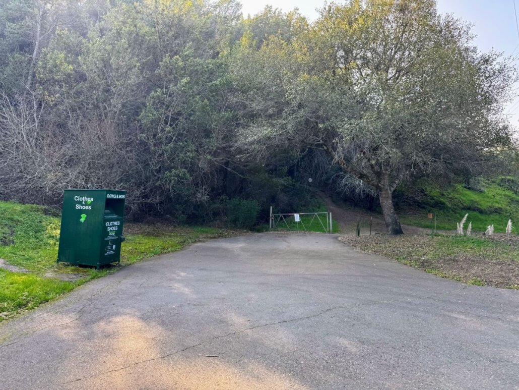
  13. The Tennis Courts: Pass the tennis courts (you’ll see restrooms on the left) and go through the trailhead gate. You’ll see a clothing donation box on the left that has been there for a long time. Go left just after the gate and head up the hill (ignore the trail to the right). You are here right now.
  14. Single Track Climb: You will hike a few minutes on a steeper incline, single-track trail through the woods. Look for a “Gas Pipeline” warning sign on the right as you approach and pass through another metal gate (again, please close it behind you).
  15. Back on the Hill: You are now back out on Horse Hill in the sun! The trail will start curving left and upward as you complete your circle. You are here right now as you hike up.
  16. Closing the Loop: You will soon arrive back at the Main Junction from Step #4. You are back here now.
  17. The Descent: To return to your car or bike, simply head back down the trail you first hiked up in Step 3. Soon you’ll be back at the bottom, with happy memories of horses, history, and nature.

Please scroll down to see the visual Horse Hill Hike walkthrough below.

Horse Hill Hike Walkthrough
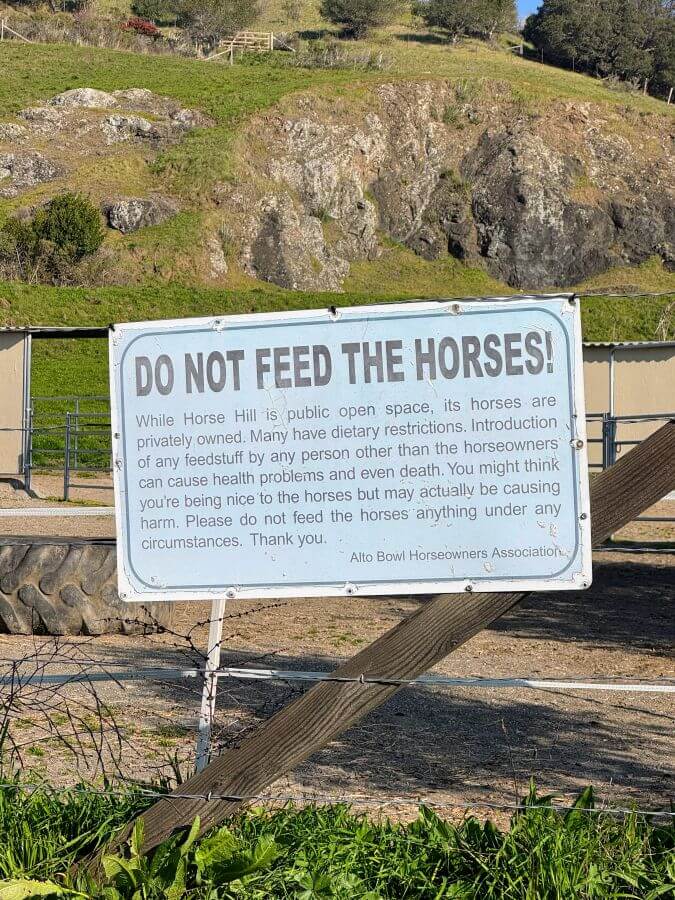
A large white sign reads, “DO NOT FEED THE HORSES!” and explains that feeding can harm horses due to dietary restrictions. The sign is posted outdoors, near a fence and grassy hillside with rocks in the background.
Horse Hill Hike Parking Lot in Mill Valley CA with bike path on the right and hwy 101 outside fence to the right

#1

Start at the Lot: Park in the designated parking lot and enter through the trailhead gate to the north (the freeway will be on your right). Please be sure to close the gate behind you to keep the horses safe.
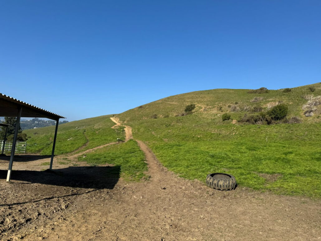
A dirt trail winds up a grassy hill under a clear blue sky. On the left, part of a metal-roofed shelter is visible, and an old tire lies on the ground near the trail.

#2

  1. The Feed Area: You will enter a dirt area with large tires on the ground used to hold feed for the horses. If you’ve timed your visit right, you won’t see any horses here because they are already grazing up on the hill!
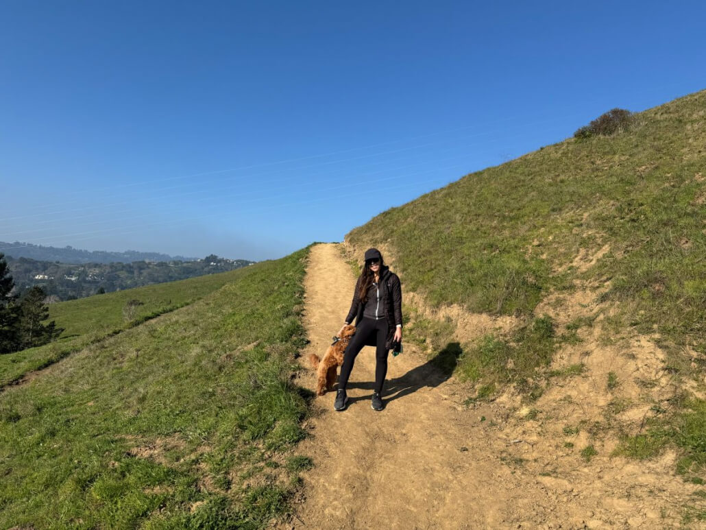
A woman dressed in black walks a small brown dog along a dirt trail on a grassy hillside under a clear blue sky. Trees and distant hills are visible in the background.

#3

Begin the Ascent: Go off to the left (your back towards 101) and start hiking up the dirt trail. You will be doing a counter-clockwise loop starting with the peak, winding your way around through Alto Canyon and Scott Valley Swim and Tennis Club, then back to the junction in step four. Watch where you step – the horses also use this trail!
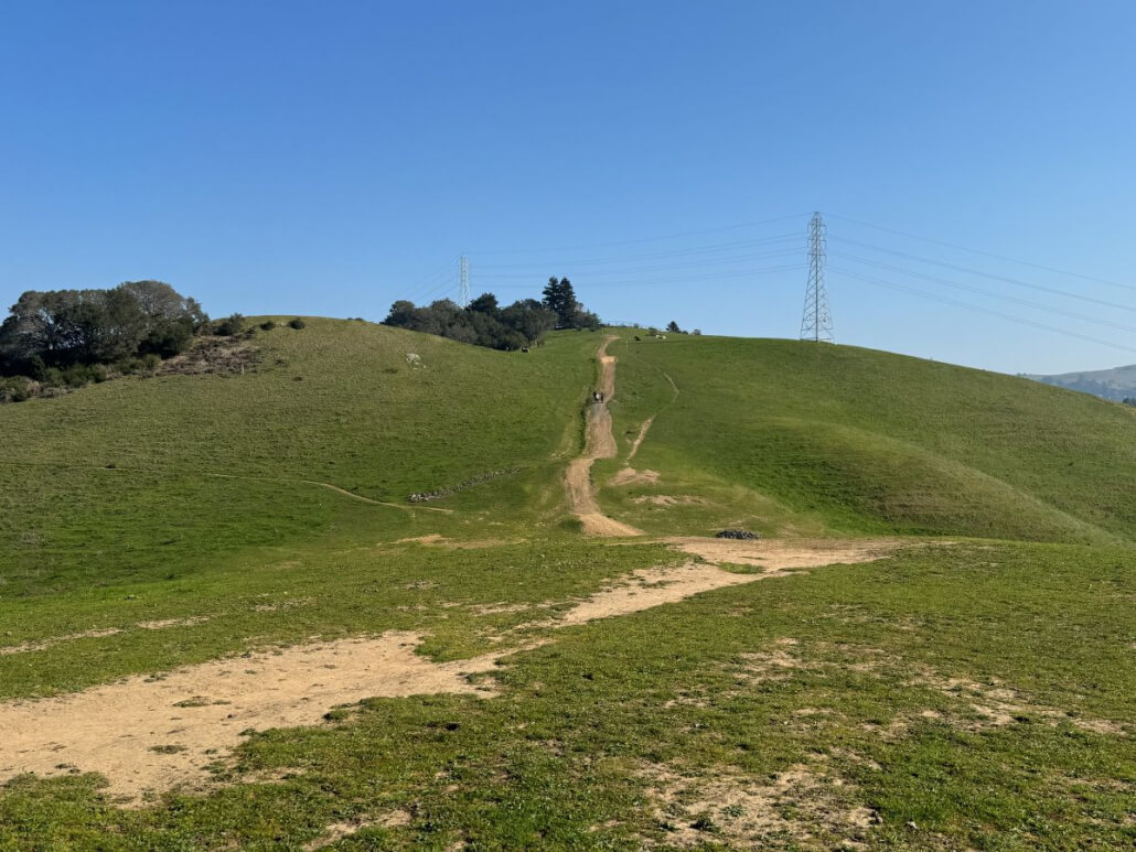
A dirt trail winds up a grassy hill under a clear blue sky on the Horse Hill Hike. Power lines and towers line the background, while a few people walk along the path toward sparse trees on the hilltop.

#4

The Main Junction: Hike up to the top and turn right on the fire road. This is the “Main Junction” you will circle back to in Step 16. You may start seeing horses at this point—remember to stay at least 20 feet away from them. You’ll see electric lines and towers on your right as you ascend. You are here now.
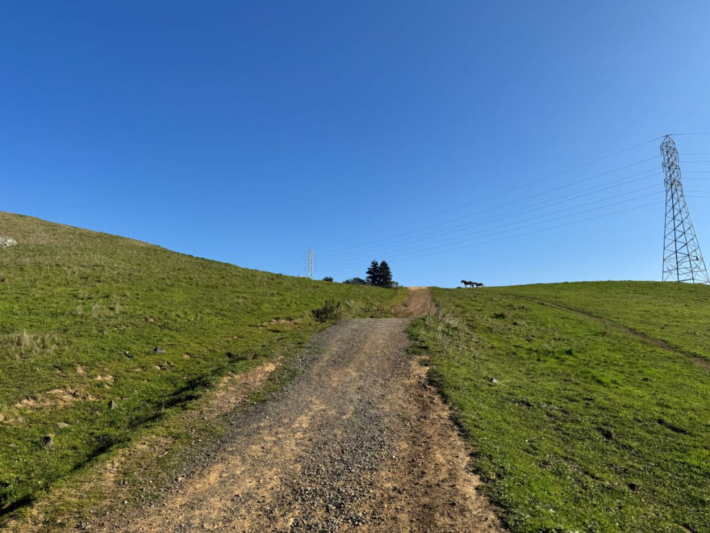
Steep uphill fire trail on Horse Hill hike with power lines in distance
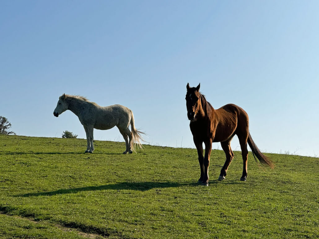
Two horses, one white and one brown, stand on Horse Hill above Mill Valley, CA under a clear blue sky. The brown horse is in the foreground, while the white horse is farther back, both illuminated by sunlight on the grassy hill.

#5

Climbing Up: Climb up this steep grade and enjoy seeing the horses!
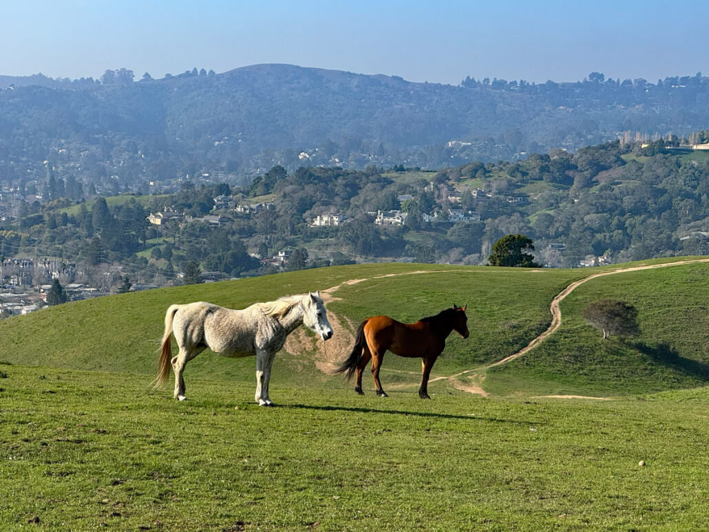
Two horses, one white and one brown, stand on a grassy hill along the Horse Hill Hike. In the background are rolling hills, scattered trees, and distant houses in Mill Valley, CA under a clear blue sky.
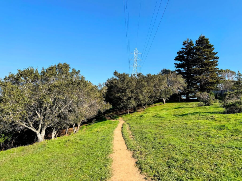
A dirt path winds through grassy Horse Hill Hike, surrounded by trees under a clear blue sky. Power lines and a tall utility tower are visible in the background.

#6

Horse Hill Trail: The trail turns left at the “Horse Hill Trail” marker. Keep the power lines to your right.

A dirt path winds through grassy Horse Hill Hike, surrounded by trees under a clear blue sky. Power lines and a tall utility tower are visible in the background.

#7

Into the Oaks: You will enter a shady area where the trail winds between mature oaks. You’ll see houses on the right (past the fence) and a “Welcome to Alto Bowl Open Space Preserve” sign. Meadowcrest Drive is visible on your right. Meadowcrest Drive is on your right
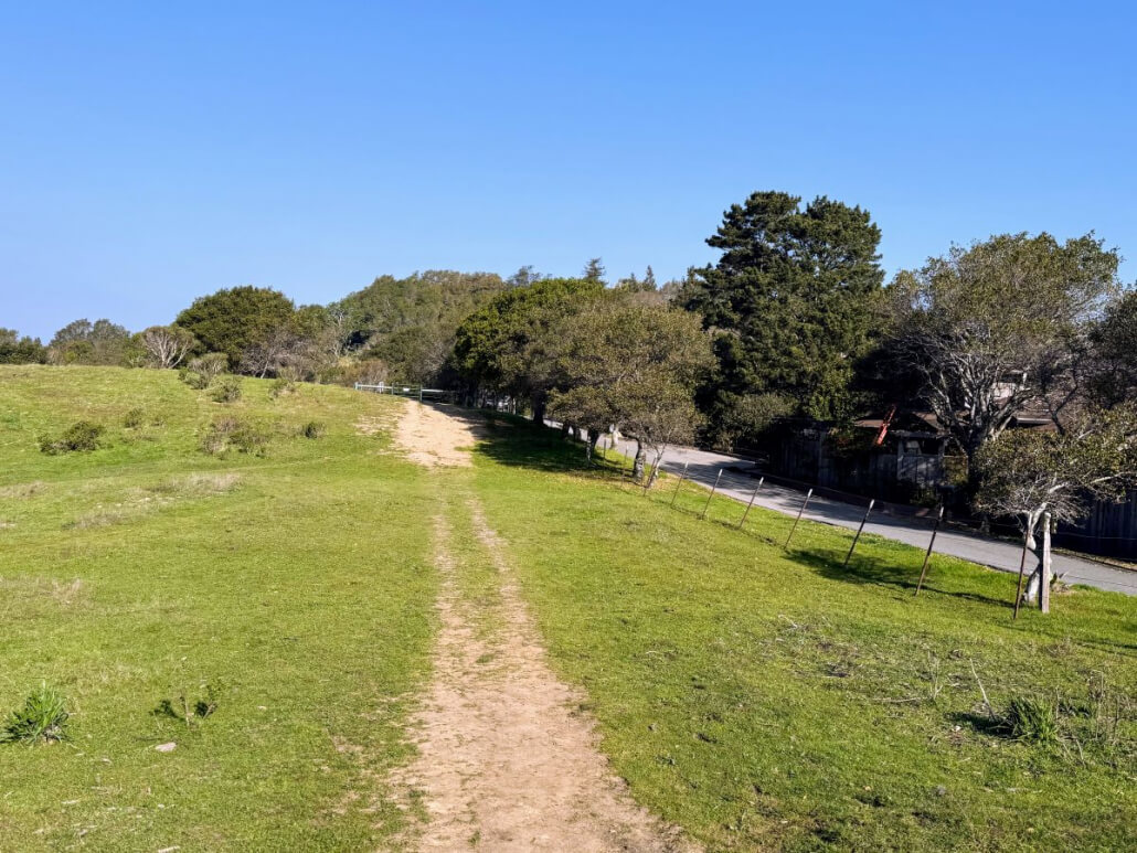
A dirt path runs through a grassy field beside a road lined with trees and a fence under a clear blue sky. In the distance, more trees and shrubs are visible.

#8

The Gate: Pass through the metal horse gate (please close it for their safety) and continue along the trail. You are here right now.
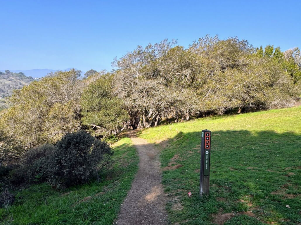
A dirt hiking trail winds through green grass and leads towards dense trees under a clear blue sky. A trail marker stands on the right side of the path.

#9

Follow the Markers: Continue along the trail through the oaks, keeping the houses on your right. You will see another “Horse Hill Trail” marker telling you to proceed straight. You are here right now.
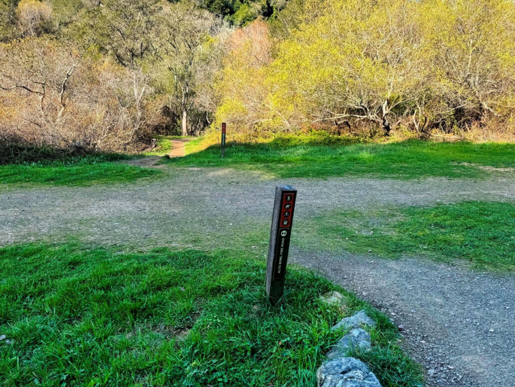
A dirt hiking trail forks in a grassy area with a trail marker post in the center. Leafy trees border the path, and sunlight brightens the scene, suggesting a peaceful outdoor setting.
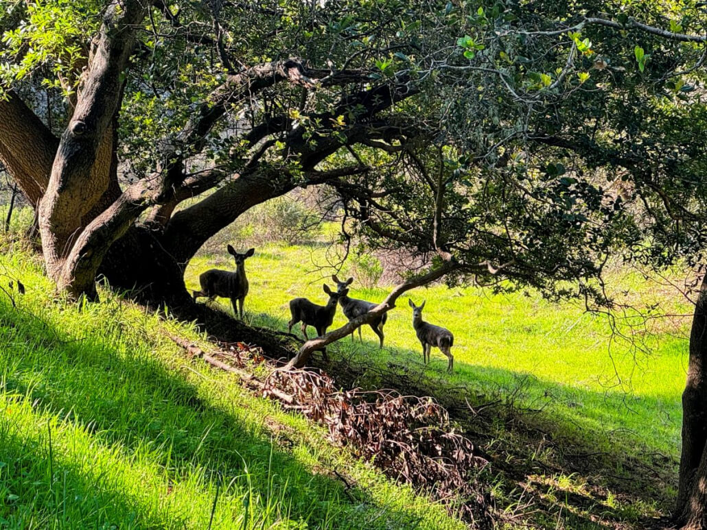
Four deer stand under the shade of a large, leafy tree on a sunlit grassy slope. Dappled sunlight filters through the branches, highlighting the green grass and casting shadows around the animals.

#10

Descent to Alto Bowl: The path widens as you descend to the Alto Bowl Fire Road trail marker, where you will turn left. You’ll see homes to your right and the Bob Midahi Trail straight ahead but don’t take that if you want to do this hike. You are here right now.
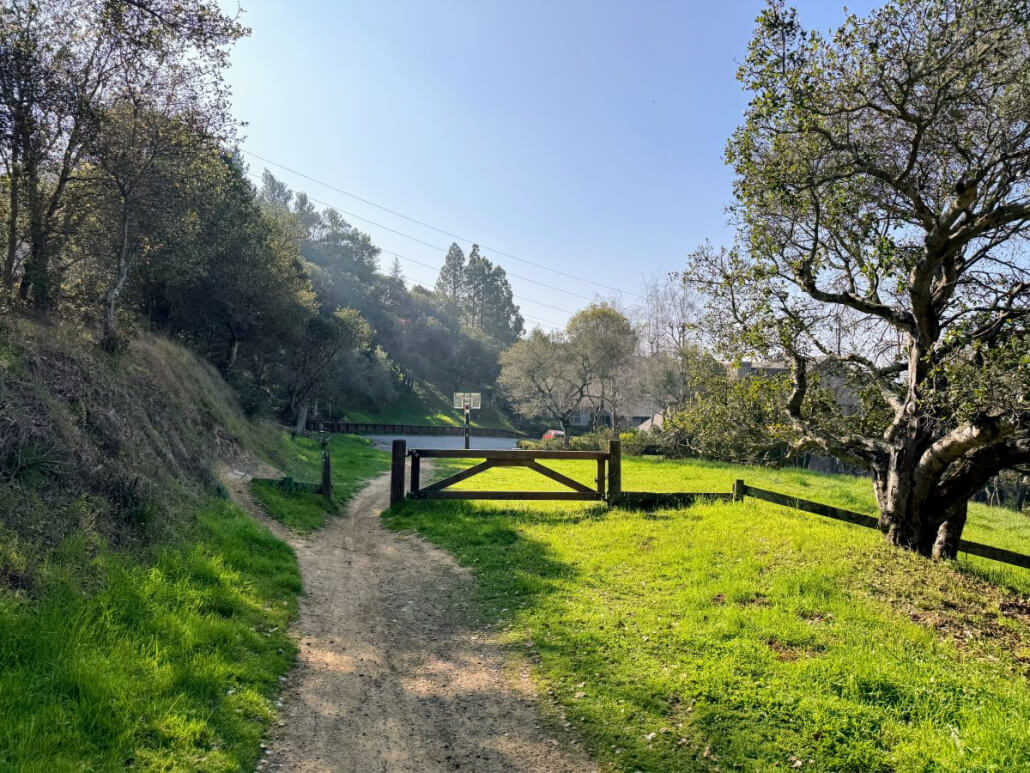
A dirt path winds through green grass and trees, leading to a closed wooden gate and fence. The sky is clear and sunny, with hills and more trees in the background—a peaceful scene along the Horse Hill Hike.

#11

Coach Road Neighborhood: Keep walking straight (this stretch becomes Coach Road.) You will emerge in a neighborhood at the intersection of Coach Road and Benson Circle, right near a beautiful Mill Valley home I sold recently.  You are here right now.
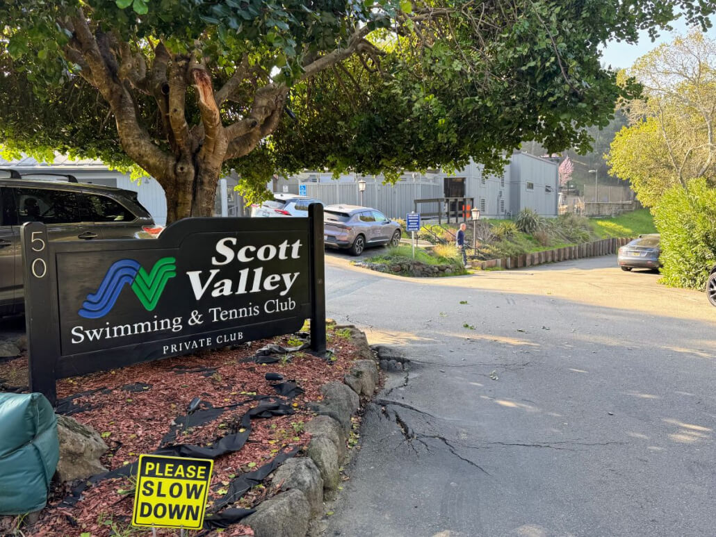
A sign reading Scott Valley Swimming & Tennis Club stands by a road with a Please Slow Down caution sign nearby. Several cars are parked under trees and in a lot next to a gray building in the background.

#12

Towards Scott Valley: Keep walking straight, crossing Underhill Road and heading into the Scott Valley Swim & Tennis Club. Walk straight towards the tennis courts. (Note: Some hikers choose to park here and start the Horse Hill Hike from this side).
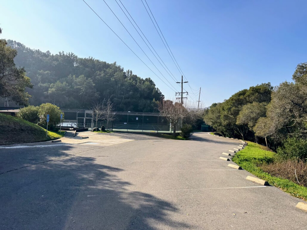
Empty parking lot next to tennis courts, surrounded by trees and greenery on a clear, sunny day. Power lines run above, and shadows are cast across the pavement.
A paved road curves past a green clothes and shoes donation bin on the left, leading toward a gate and a wooded area with trees and greenery in the background.

#13

The Tennis Courts: Pass the tennis courts (you’ll see restrooms on the left) and go through the trailhead gate. You’ll see a clothing donation box on the left that has been there for a long time. Go left just after the gate and head up the hill (ignore the trail to the right). You are here right now.
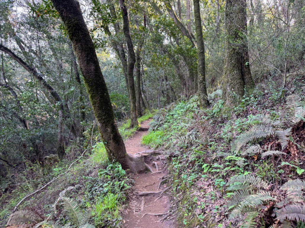
A dirt trail winds through a forest with tall trees, ferns, and lush green undergrowth. Exposed roots cross the path, and sunlight filters through the dense foliage.

#14

Single Track Climb: You will hike a few minutes on a steeper incline, single-track trail through the woods. Look for a “Gas Pipeline” warning sign on the right as you approach and pass through another metal gate (again, please close it behind you).

A dirt trail winds through a forest with tall trees, ferns, and lush green undergrowth. Exposed roots cross the path, and sunlight filters through the dense foliage.

#15

Back on the Hill: You are now back out on Horse Hill in the sun! The trail will start curving left and upward as you complete your circle. You are here right now as you hike up.
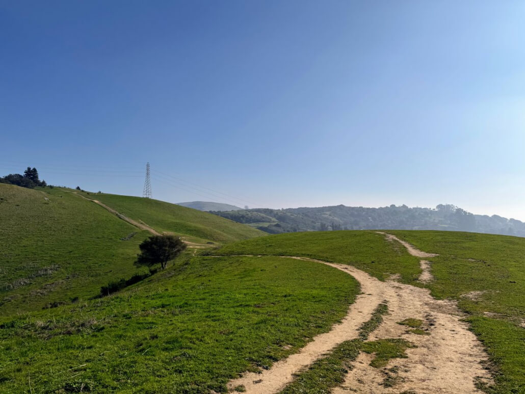
A dirt path winds through a green grassy hillside under a clear blue sky on the Horse Hill Hike. A single tree stands near the path, while power lines supported by a tall metal tower cross the background hills.

#16

Closing the Loop: You will soon arrive back at the Main Junction from Step #4. You are back here now
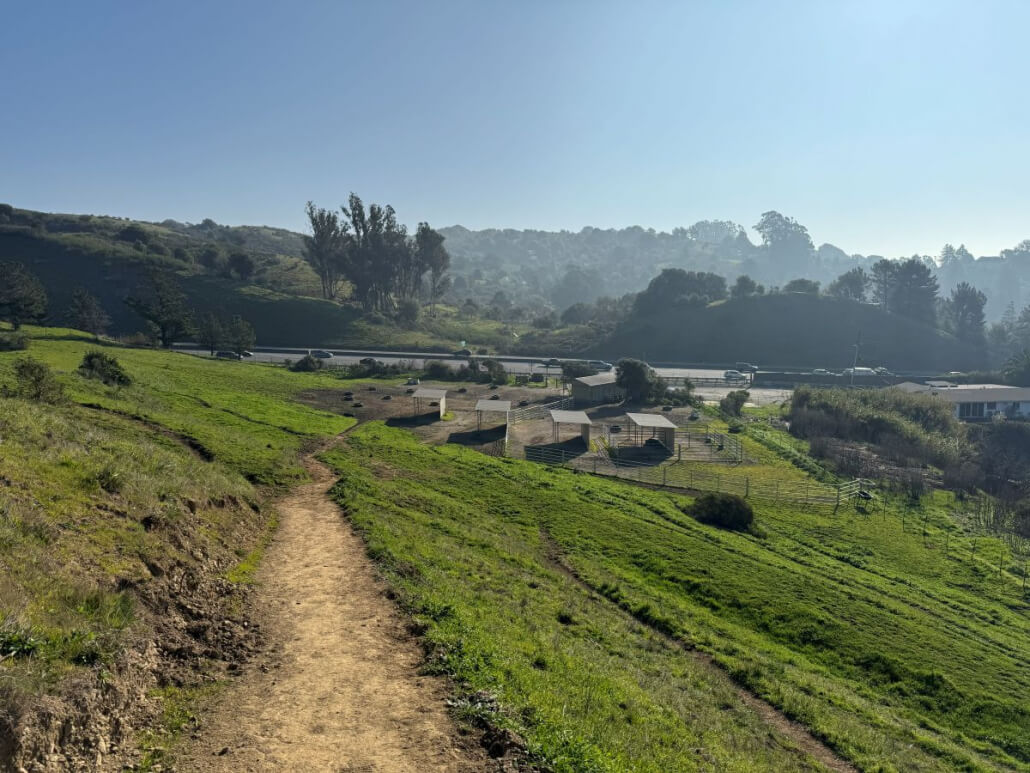
Horse Hill Hike trail looking towards parking lot with Hwy 101 in the distance

#17

The Descent: To return to your car or bike, simply head back down the trail you first hiked up in Step 3. Soon you’ll be back at the bottom, with happy memories of horses, history, and nature.

In Conclusion

I hope you have enjoyed reading my article about one of my favorite hikes at the end of Freitas Parkway. If this is your first visit to my Marin Real Estate and Lifestyle Blog, please have a look at my other articles. They all feature original articles about the things that make Marin County such a great place to live — restaurants, hikes, and even profiles of those who live here.

Also in my blog is my monthly Marin real estate market update. As a top real estate agent here in Marin County, I truly love what I do and would love to help you attain your own real estate goals. Please call or text me at 415.847.5584 and I’ll be in touch right away. Otherwise, I will see you on the trails!

Click Here to Read My Other Marin Hiking Blog Articles
Marin top real estate agent Thomas Henthorne headshot

About the Author

Thomas Henthorne is consistently top-ranked, award-winning real estate agent in Marin, helping people buy and sell homes for almost a decade. He writes the #1 real estate blog in Marin County and is a frequent speaker on panels at industry gatherings.

He may be reached at 415-847-5584.

Learn More About Thomas Henthorne

Click Here to Contact Thomas

Please call / text Thomas at 415-847-5584 or fill out this contact form and he will be in touch right away.

Join the V.I.P. List

Sign Up for My Newsletter Here

Share This Article With Your Friends
  • Share on Facebook
  • Share on X
  • Share on Pinterest
  • Share on LinkedIn
  • Share by Mail

Tell Me What You Think

Additions, comments and corrections welcome.

0 replies

Leave a Comment

What do you think?
Please leave your comment below!

Leave a Reply Cancel reply

Your email address will not be published. Required fields are marked *

Quick Homes Search

Search My Site:

Search Search

The Latest From My Blog

  • Marin County Market Report August 2026: Sold price $1.5M up 10%, 367 homes for sale down 27%, 44 days on market down 19%, and housing inventory at 1.6 months supply, a decrease of 38%. Includes Realtor contact information, with the Golden Gate Bridge featured in the background.
    Monthly Marin County Real Estate Market Report | August 2026

    Marin’s late-summer real estate market remains defined by limited supply and steady buyer activity. Closed sales rose 23.2% year over year, inventory fell 27%, and the median sold price increased 9.7%. This month’s report looks at pricing power, buyer selectivity, tight inventory, and the Bay Area wealth trends shaping Marin demand.

  • Things to do in the SF Bay Area August 2026
    Things to Do in the San Francisco Bay Area | August 2026

    Explore the best things to do in the San Francisco Bay Area in August 2026, including summer festivals, outdoor concerts, art fairs, food and wine events, cultural celebrations, and community gatherings across Marin, San Francisco, the East Bay, the Peninsula, South Bay, and Wine Country.

  • July 2026 Marin County Market Report: Median sold price up 9%, homes for sale down 25%, days on market up 5%, supply down 34%. Photo of a dining room featuring large windows that showcase lush greenery outdoors.
    Monthly Marin County Real Estate Market Report | July 2026

    Marin’s summer real estate market remains defined by scarcity. With fewer homes available, buyers continued to compete for well-positioned properties, pushing the median sold price higher and keeping months of supply low. This month’s report looks at pricing, inventory, buyer behavior, and how Bay Area AI-driven wealth continues to influence upper-end demand.

  • Marin county fair logo for things to do in July 2026 blog article
    Things to Do in the San Francisco Bay Area | July 2026

    Explore the best things to do in the San Francisco Bay Area in July 2026, including Fourth of July fireworks, the Marin County Fair, summer concerts, food and wine events, festivals, and community celebrations across the Bay Area.

Please Subscribe to My Newsletter Here:

Thomas Henthorne

Thomas Henthorne
+1.415.847.5584
thomas@thomashenthorne.com
Top Marin Real Estate Agent
DRE# 01892608

Thomas Henthorne

The Henthorne Group, Inc.
+1.415.847.5584
DRE# 01892608
Golden Gate Sotheby's International Realty
500 Drakes Landing Road
Greenbrae, California 94904
thomas@thomashenthorne.com
Let’s tell the next success story.™
Top Agent Network logo

Contact Thomas Henthorne here or call/text 415-847-5584

Contact Thomas Here

Accessibility Settings

Copyright © 2026 Thomas Henthorne and The Henthorne Group Inc., All Rights Reserved. All content provided on this site and Marin Real Estate Blog is for informational purposes only. The owner of this website makes no representations as to the accuracy or completeness of any information contained herein or found by following any link on this site. The owner of thomashenthorne.com will not be liable for any errors or omissions in this information nor for the availability of this information. The owner will not be liable for any losses, injuries, or damages from the display or use of this information. “Sotheby’s International Realty® is a registered trademark licensed to Sotheby’s International Realty Affiliates LLC. Each Office Is Independently Owned and Operated.” Privacy Policy Sitemap Accessibility
  • Link to X
  • Link to Facebook
  • Link to Instagram
  • Link to Youtube
  • Link to Pinterest
  • Link to LinkedIn
  • Link to TikTok
  • Link to Vimeo
  • Belvedere
  • Corte Madera
  • Fairfax
  • Greenbrae
  • Kentfield
  • Larkspur
  • Mill Valley
  • Novato
  • Ross
  • San Anselmo
  • San Rafael
  • Sausalito
  • Stinson Beach
  • Tiburon
Link to: Things to Do in the San Francisco Bay Area | February 2026 Link to: Things to Do in the San Francisco Bay Area | February 2026 Things to Do in the San Francisco Bay Area | February 2026Things to do SF Bay Area Feb 2026 Link to: Marin County Real Estate Market Report February 2026 Link to: Marin County Real Estate Market Report February 2026 February 2026 Marin county real estate market report graphic showing median sold price, number of homes for sale, days on market and months of supply metricsMarin County Real Estate Market Report February 2026
Scroll to top Scroll to top Scroll to top

This site uses cookies. By continuing to browse the site, you are agreeing to our use of cookies.

OK

Cookie and Privacy Settings


How we use cookies

We may request cookies to be set on your device. We use cookies to let us know when you visit our websites, how you interact with us, to enrich your user experience, and to customize your relationship with our website.

Click on the different category headings to find out more. You can also change some of your preferences. Note that blocking some types of cookies may impact your experience on our websites and the services we are able to offer.

Essential Website Cookies

These cookies are strictly necessary to provide you with services available through our website and to use some of its features.

Because these cookies are strictly necessary to deliver the website, refusing them will have impact how our site functions. You always can block or delete cookies by changing your browser settings and force blocking all cookies on this website. But this will always prompt you to accept/refuse cookies when revisiting our site.

We fully respect if you want to refuse cookies but to avoid asking you again and again kindly allow us to store a cookie for that. You are free to opt out any time or opt in for other cookies to get a better experience. If you refuse cookies we will remove all set cookies in our domain.

We provide you with a list of stored cookies on your computer in our domain so you can check what we stored. Due to security reasons we are not able to show or modify cookies from other domains. You can check these in your browser security settings.

Other external services

We also use different external services like Google Webfonts, Google Maps, and external Video providers. Since these providers may collect personal data like your IP address we allow you to block them here. Please be aware that this might heavily reduce the functionality and appearance of our site. Changes will take effect once you reload the page.

Google Webfont Settings:

Google Map Settings:

Google reCaptcha Settings:

Vimeo and Youtube video embeds:

Privacy Policy

You can read about our cookies and privacy settings in detail on our Privacy Policy Page.

Privacy Policy
Accept settingsHide notification only